STAGE 02
DAY TWO
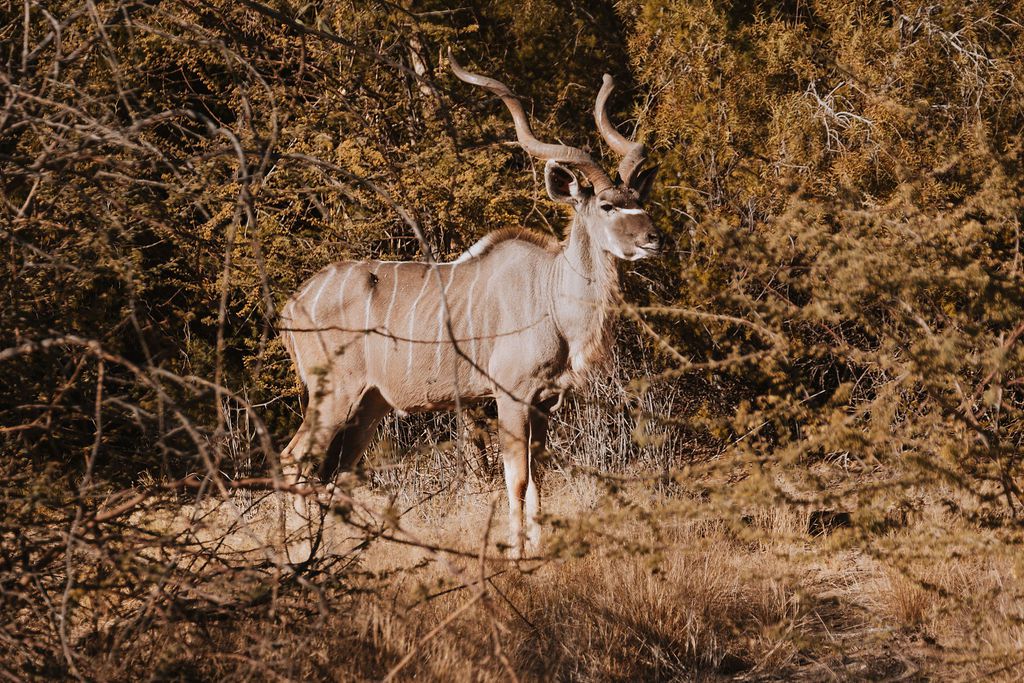
Day two of the Trans Augrabies MTB Stage Race focuses on the Augrabies Falls National Park, offering a challenging route with amazing wild life along the way.
LET'S TAKE YOU ON THE JOURNEY
Stage 2 follows the same scenic route as Stage 1 for approximately 8 km along an open gravel road with rolling hills and three cold, slippery water crossings—take care not to fall here!
Along this section, you'll once again be amazed by the rock collar formations, which are even more prominent than on the previous day. Keep an eye out for giraffes—you’ll likely spot a few—and if you’re lucky, you might even catch a glimpse of a leopard.
The road surface is generally good, but can become sticky in places.
At the 8 km mark, turn left onto a jeep track that backtracks part of Stage 1.
This section climbs gradually until around 13.5 km. Stay focused, as the loose gravel demands your attention—but don’t forget to glance ahead and to your right to enjoy the spectacular views stretching to the north.
At 14 km, turn left onto the Augrabies Park tourist route. From here, the road descends gently, and you’ll likely be spinning out your gears as you enjoy the fast-flowing gravel all the way to the first water point at 17 km.
Just after passing beneath a culvert bridge, turn right—the water point will be located immediately after the crossing.
From the 17 km mark, look ahead in a north-western direction—you’ll spot Speëlkop, a distinctive hill once used by Boer settlers to signal one another using mirrors. They communicated with farms in Kakamas, about 57 km to the south-east, by reflecting sunlight upstream along the Orange River.
From here, follow a jeep track through remote terrain with limited cell phone reception and several technical features. Stay focused—there are five notable sandy sections, each between 10 and 50 metres long. If your tyre pressure is well set and you choose the correct line, all of them are rideable. The first 4 km of this section are still gently downhill and enjoyable, including a small sand riverbed crossing.
The next 9 km bring rolling terrain with short climbs and descents, along with a few rocky downhills that demand control and attention. As you ride, take in the many striking rock formations, each with its own shape, colour, and texture.
This section ends as you arrive at Blouputs Buite Pos, near the old entrance road leading into the iconic Blouputs Valley.
From Blouputs Buitepos, the route continues along a 2.7 km winding track with a steady, dragging climb. As you ascend, the prominent ±300 m high Speëlkop—the highest point in the park at 904 metres above sea level—will dominate your view ahead, positioned between 12 o’clock and 3 o’clock on your horizon.
Take a moment to appreciate the panoramic views toward this impressive granite formation. It’s more than just a “koppie"—it’s a mountain in its own right, and a landmark that adds a powerful visual signature to this stage of the ride.
This section is fast and flowing, but includes a few sharp corners and sudden dips—so stay alert and ride with care. It’s an enjoyable part of the route, but overconfidence here could lead to a fall.
The final 7 km to the second water point at 43 km is a steady, dragging climb that will test your resolve. This is where the mental game becomes real—you may start questioning your decision to enter the race, especially as the short, punchy climbs chip away at your energy.
Stay focused, watch for wildlife and leopard tracks in the sandy sections, and keep your momentum. Around the 40 km mark, you may catch sight of the next water point—offering a flicker of hope. That’s when it hits you:
You’re tougher than you thought.
From the second water point at 43 km, continue along a gravel road that follows the Augrabies tourist route until the 72 km mark. Here, you’ll turn left onto a sandy jeep track.
The first 3 km of this segment are slightly uphill but feature a smooth surface—you'll likely feel a temporary boost in morale.
From 46 km, the route trends gently downhill for the next 11 km. If there’s a slight tailwind, you may find an opportunity to recover somewhat. However, stay alert for wildlife—springbok, eland, gemsbok, and others may suddenly dart across the road at high speed, sometimes appearing to “race” you across the path.
Be cautious of loose gravel in the corners; taking them too fast could land you between very coarse rocks. As you ride, take note of the dramatic shift in landscape compared to earlier in the day—this is quiver tree territory, with fascinating shapes and variations of these iconic trees throughout the area.
From around 57 km, the road begins a gradual uphill stretch that continues to the 64 km mark, where you’ll reach the third water point. By now, your legs may start cramping, your pace might have dropped, and you’ll realise this has been a hard-earned section. Fortunately, water point 3 offers salt and potatoes—just what you need to fight off cramping and restore energy.
The only significant obstacle in this stretch is a short, paved, punchy climb at 70 km—one of a few similar paved climbs found only in this part of the stage.
The first 1.2 km takes you down a sandy jeep track leading into the well-known Klipspringer Hiking Trail. From there, the trail climbs gently to the 75 km mark with a pleasant, flowing rhythm. Simply follow the 20 cm x 15 cm Klipspringer trail markers—just lift your head and you’ll see the next sign about 100 metres ahead, generally between the "quarter to" and "past 12" positions on your visual clock.
At around 75 km, you’ll enter the rugged Swartrante section of the trail. Here, you’ll need to carry your bike for about 50 metres up to the top—yes, it’s short but steep, and yes, you’ll probably ask yourself why again.
From the top of Swartrante, it’s mostly downhill all the way to Oranjekom Viewpoint, where the fourth and final water point awaits. Be extremely careful on this last stretch—there are a few obstacles, and the surface is unforgiving, like coarse sandpaper. A fall here would be painful.
When you reach Water Point 4 at Oranjekom, take a moment to stop, breathe, and enjoy one of the most breathtaking views over the gorge where the Orange River flows far below—it’s a moment to remember.
From Oranjekom, the route climbs gently for approximately 2 km along a gravel road that reconnects with the main tourist route. At 83 km, turn off toward Moonrock.
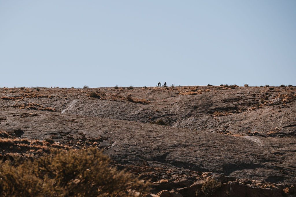
At around 84 km, you’ll arrive at Moonrock—a 700 m granite outcrop that you'll ride over. The first 500 m is uphill and feels like pedaling on an ancient Roman cobblestone road. Moonrock is a solid granite formation that rises about 30 metres above the surrounding landscape and, from a distance, resembles the shape of a whale.
Make a point to stop at the top, take in the 360-degree panoramic view, and say to yourself, “I did it—thank you.” From this moment onward, the finish line is in sight.
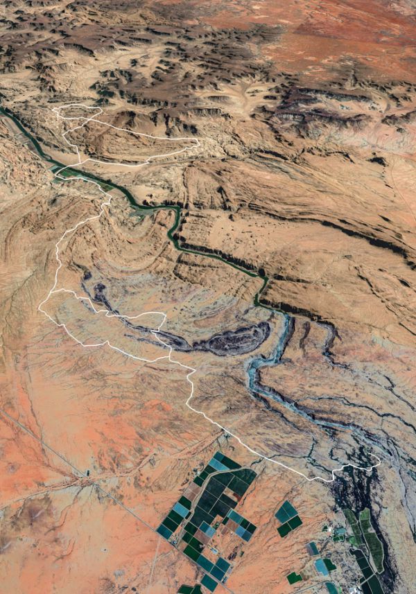
DAY TWO ROUTE


